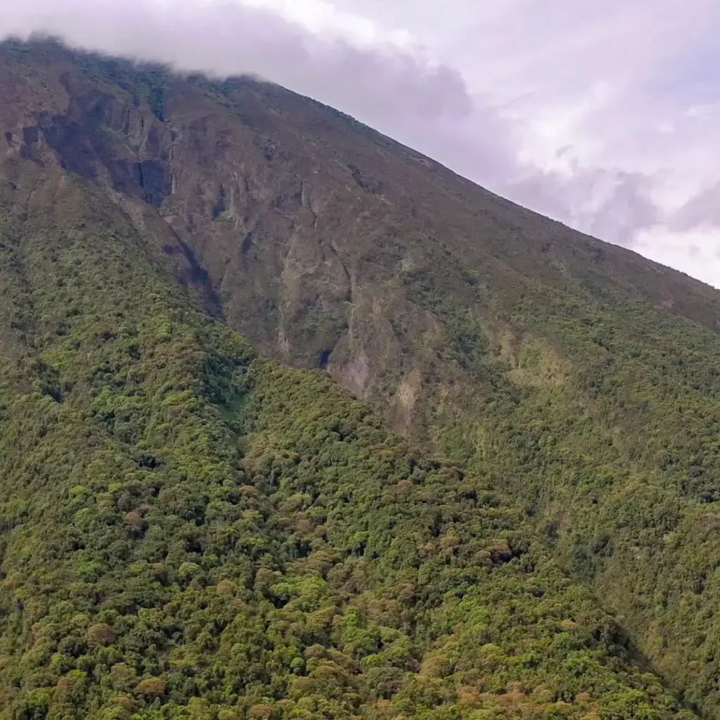
Mount Elgon is one of the great mountains of East Africa: an extinct volcano on the border of Uganda and Kenya, said to have once stood higher than Kilimanjaro before it eroded, with one of the largest volcanic calderas in the world. Its highest point, Wagagai, at 4,321 metres, lies entirely in Uganda. The hiking is gentle by the standards of East African mountains: no technical skills are needed, the crowds are small, and three trails offer different characters and lengths.
The mountain and the park
- Summit: Wagagai at 4,321 metres. Other summits include Jackson’s Summit (about 4,200 metres) and Masaba (about 4,024 metres).
- Park: Mount Elgon National Park covers about 1,279 square kilometres. The mountain is shared with Kenya, and more than half of it, including almost all of the caldera, lies in Uganda.
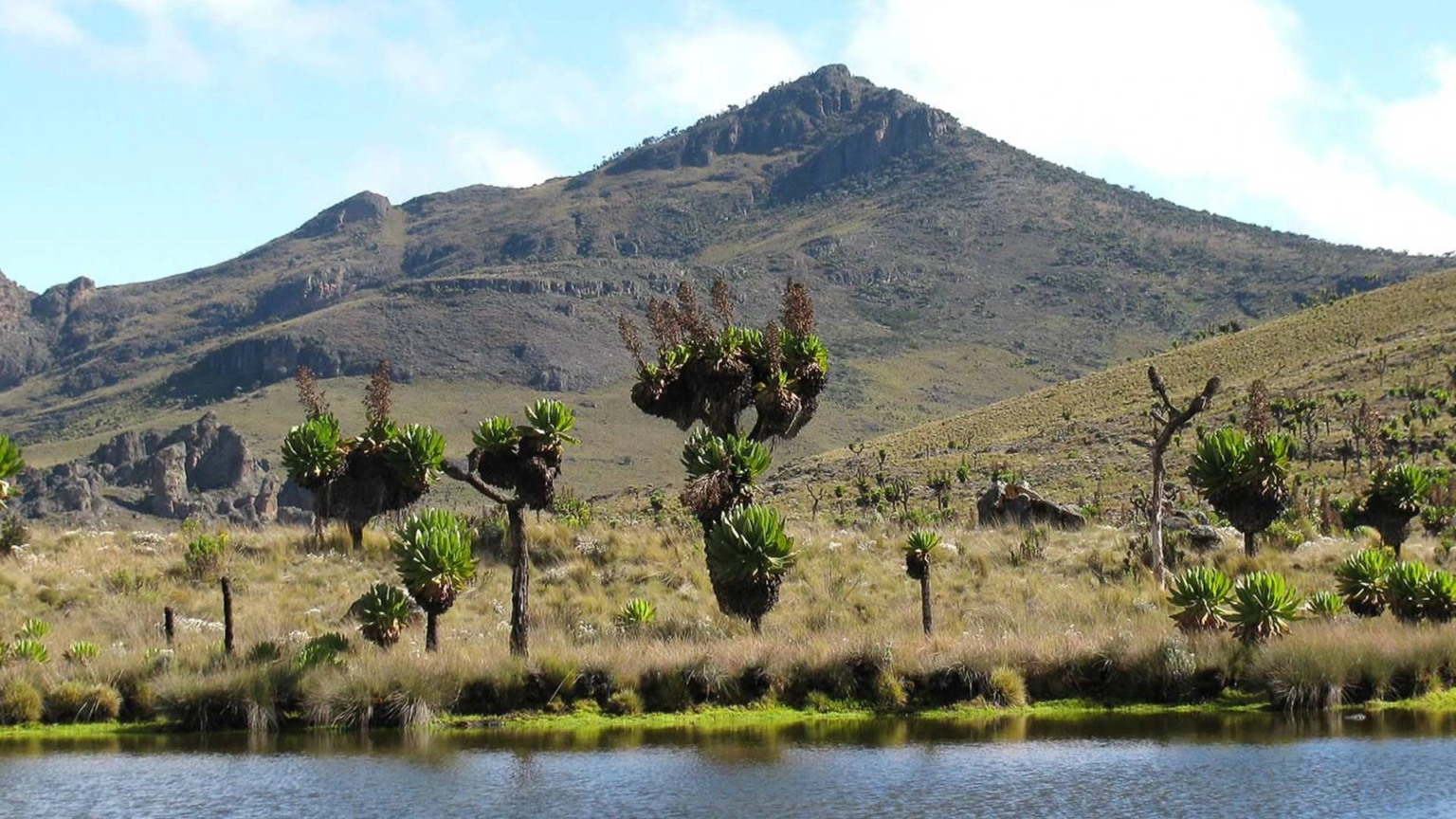
- Wildlife and plants: montane forest, bamboo, heath and moorland with giant lobelias and groundsels; black-and-white colobus, blue monkeys and more than 300 bird species.
- Caldera sights: hot springs, gorges such as Suam and Simu, caves and Jackson’s Pool.
The three main trails
Sasa trail: the shortest and steepest
The original route to Wagagai starts at Budadiri, where the Uganda Wildlife Authority has its office, at about 1,250 metres. It climbs fast, through farmland, forest and bamboo, up the Mudangi cliffs by ladders, past Sasa River camp and on to Mude camp at about 3,500 metres, then up to Wagagai. Most people take three to four days for the return hike. The first day is a hard climb of more than 1,600 metres, so this trail suits fit hikers with limited time.
Sipi trail: the gentle one with the most wildlife
The Sipi trail starts at Kapkwai Forest Exploration Centre at about 2,050 metres, a short way from Sipi Falls. Because it starts higher and climbs more gradually, it is good for acclimatising and for wildlife, with the most forest and primates of the main trails. It passes Tutum Cave. A full trek takes four to six days and covers around 56 kilometres.
Piswa trail: the quiet one
The Piswa trail begins near Kapkwata in Kween District, on the northern side, and is the quietest of the main routes. The ascent is gentle, through podocarpus forest and heath and moorland, with wide views over the Karamoja plains towards Mount Kadam and Mount Moroto. It passes the hot springs inside the caldera. It is the longest, at about 49 kilometres and up to seven days.
Shorter alternatives
- Kapkwai day walks of 3 to 7 kilometres. See our page on the Kapkwai Forest Exploration Centre.
- Sipi Falls hikes. See our page on Sipi Falls.
- Mountain biking on trails opened in 2012 near Sipi.
How the hikes work
- Rangers: the Uganda Wildlife Authority provides armed rangers to escort each group.
- Porters and cooks: strongly recommended, both for comfort and to support local communities.
- Camping: basic campsites and, on some routes, mountain huts or cave camps. Camping gear is normally provided and we arrange it.
- Fitness and altitude: the summit is above 4,000 metres, so altitude headaches are possible. Read our Health & Safety page and tell us about any medical conditions.
What to bring
Broken-in hiking boots, layers including a warm jacket, waterproofs, a hat and gloves, a head torch, sun protection, a water bottle and trekking poles. Nights at the higher camps are cold.
Practical information
- Getting there: Budadiri is reached via Mbale, about three to four hours from Kampala; Kapkwai and Piswa via Sipi and Kapchorwa.
- Best time: December to March is the driest. The rains are heavier from roughly April to October, making the trails slippery.
- Permits: required from the Uganda Wildlife Authority. Fees change and we confirm them at booking.
Hike Mount Elgon with Offmap Safaris
We pair Elgon hikes with Sipi Falls, Jinja and Kapchorwa. Plan your safari, message us on WhatsApp +256 701 243 304 or email [email protected]. Please also read our Responsible Travel page.